NYC Building Permits Dashboard
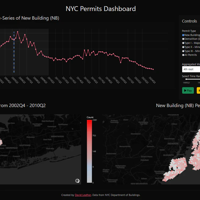
Project Overview I developed a sophisticated web-based dashboard that transforms raw NYC building permit data into interactive, actionable visualizations. This project demonstrates my expertise in data processing, geospatial analysis, and full-stack development. View the live dashboard here. Key Technical Achievements Advanced Data Processing: Implemented efficient data pipelines using Pandas and GeoPandas to handle large-scale permit datasets Interactive Visualization: Created dynamic visualizations using Dash and Plotly, enabling real-time data exploration Geospatial Analysis: Developed innovative hexagonal mapping techniques to visualize permit density across NYC Scalable Architecture: Designed a modular codebase that separates concerns and enables easy maintenance Technical Implementation Data Processing Pipeline The dashboard’s backend leverages Python’s data science ecosystem to clean and transform raw permit data:
Feb 17, 2025
QuadraticKalman.jl
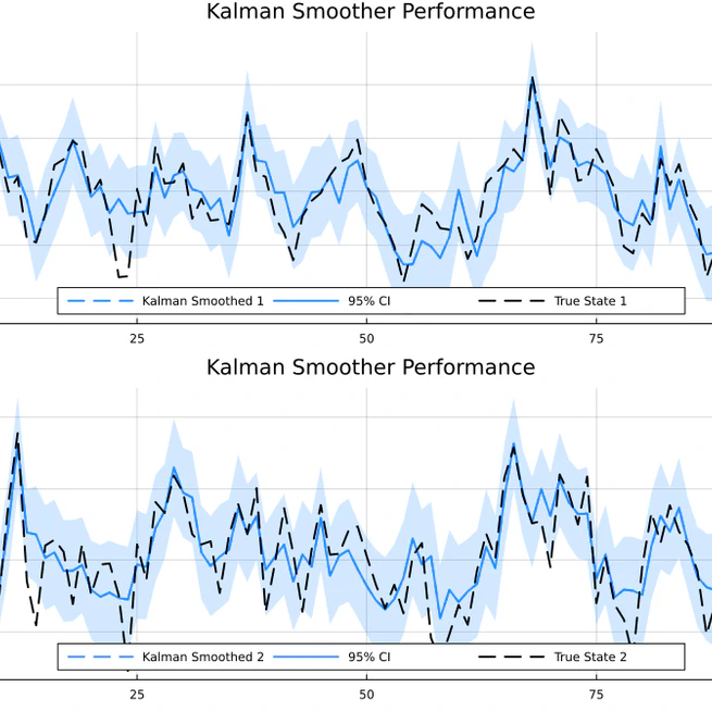
QuadraticKalman.jl is a publically available Julia package for filtering and smoothing state-space models with quadratic measurement equations. The package implements an augmented state-space approach that converts nonlinear quadratic terms into a linear system by tracking both first and second moments. This allows exact filtering up to second moments while using standard Kalman filter recursions. The package provides efficient implementations of filtering, smoothing, likelihood evaluation, and parameter estimation for these models. Key features include support for autoregressive measurements, automatic differentiation for optimization, visualization tools, and numerically stable implementations that are significantly faster than existing alternatives.
Jan 31, 2025